
The Limits of Modeling
Chaos theory, climate models, annihilation of mystery, approximate maps, and melting ice. An essay about Earth's decreasing albedo and the loss of its radiance.

“It is not down on any map; true places never are.” — Herman Melville, Moby Dick
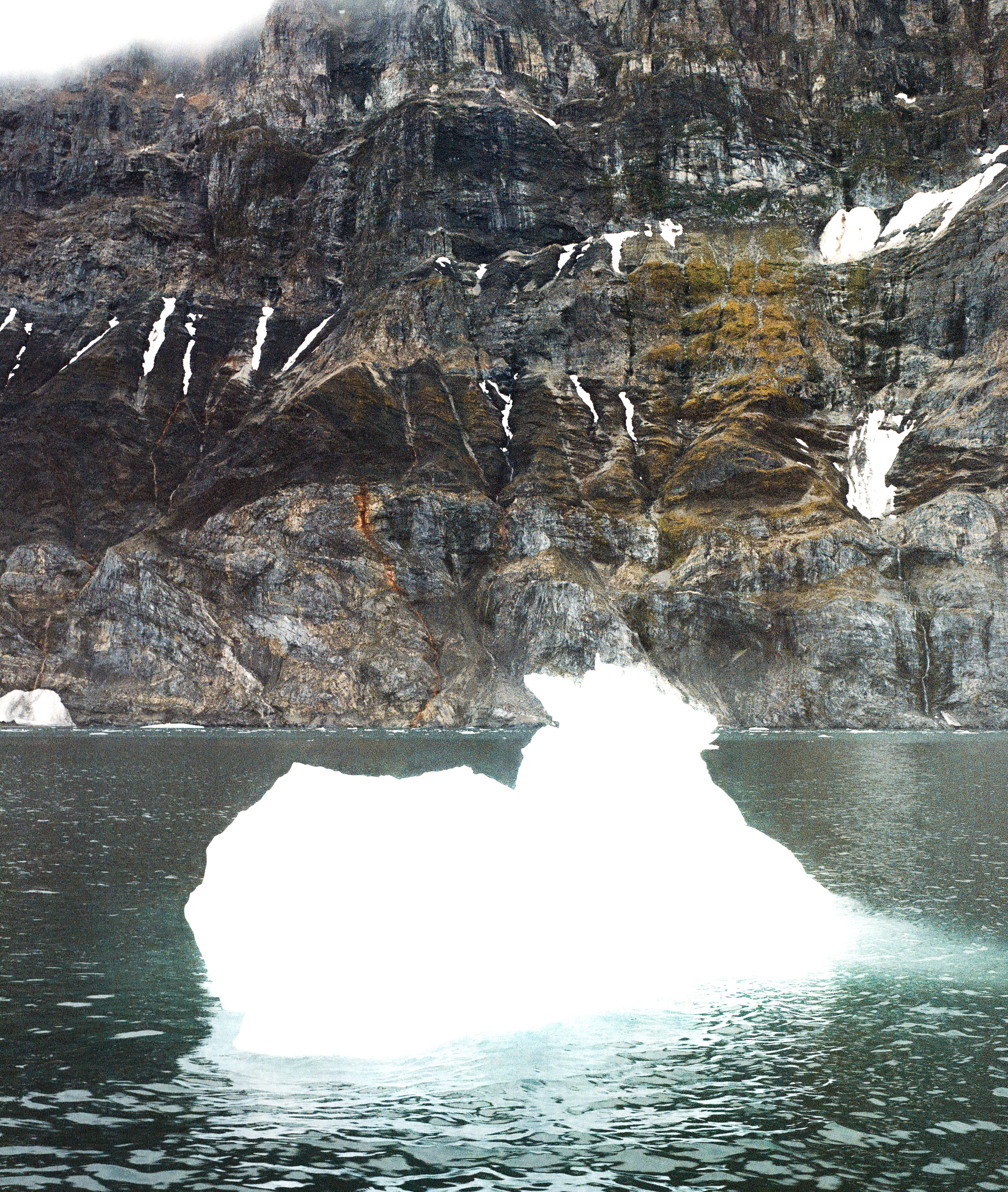
A monitor on the ship’s bridge illuminates the X-band radar pings of surrounding icebergs. The dots are so numerous it appears as if we’re sailing through a celestial mist of LED stars. We’ve just crossed 82° North and the Arctic Ocean heaves with bright ice that radiates an unsettling clicking noise.
While studying that nebula of pings, the founder of the residency I’m on told me that once during a previous trip their GPS display said they were smack in the middle of a glacier. Being in motion and all, they were evidently not shackled in the ice. The glacier’s terminus was a mile away and the moment of panic was due to a deficit in the GPS data—the glacier had melted considerably since the last time it was mapped years ago.
It is August 2024—the hottest month recorded on Svalbard—and I’m told a lot has changed here over the years. That’s to be expected for a glacial archipelago warming six times faster than average. But I am not here to collect data—I leave that to the scientists—nor to ‘raise awareness’ by photographing starving polar bears—I don’t know how many more images of that we need.
I’m here because I haven’t been able to create a decent picture of this place with my (now former) employer’s satellites. It is a landscape that resists our attempts to map it. It alternates between months-long polar darkness and blinding white. I’ve spent hours poring through this pixelated void, my retinas seared like hanger steak, cursing at its noncooperation.
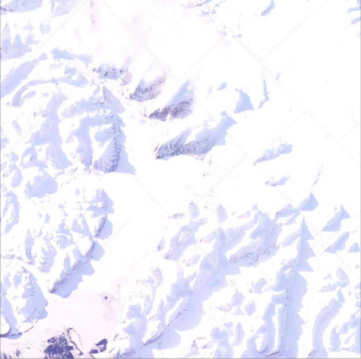
At some point it can even feel like a digital version of a white-out: a polar phenomenon that occurs when low-lying clouds reflect sunlight in such a way as to annihilate shadows and depth perception. It is said to be a disorienting experience. The horizon is indiscernible and the very senses we use to comprehend the world come into question.
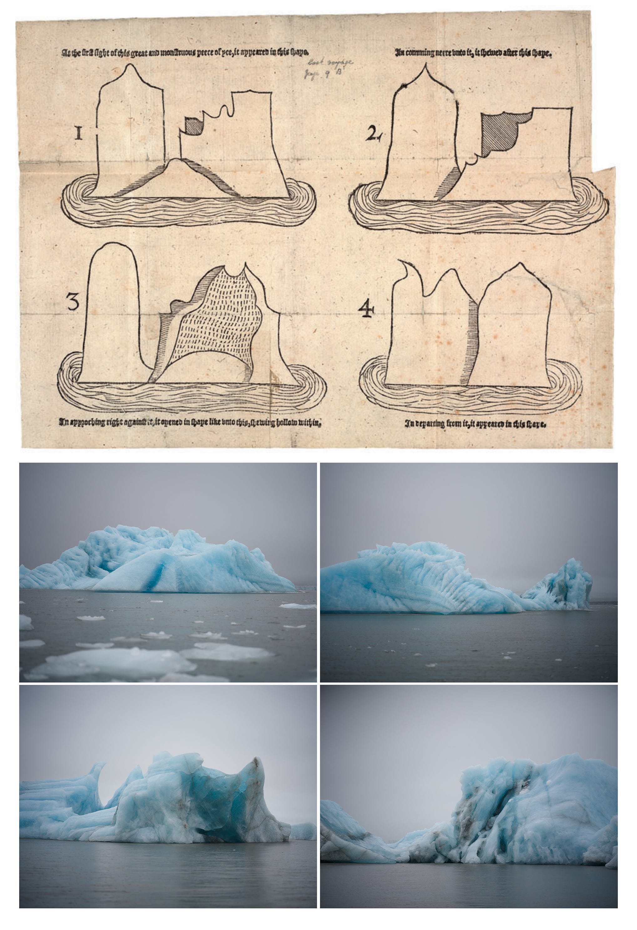
I’m not the first person to struggle with Arctic documentation from a Western standpoint—it’s practically the place’s heritage by now. Early European explorers of its choppy waters brought along parchment and wooden blocks to document the strange sights and creatures they expected to stumble across at the end of the Earth. In the late 16th century, Thomas Ellis, the artist onboard one of these endeavors, struggled to visually depict an iceberg. Its dimensions appeared to challenge Euclidean space like a Mobius strip, its colors ill-defined like a shifting aurora. As Christopher P. Heuer writes, Ellis was perplexed in his confrontation of an object that “simply did not fit into European schemes of pictorial composition, space, selfhood, and communication.”
The frontiers of the scientific unknown are undoubtedly exciting and our species has a knack for plunging headfirst into them. Some of these boundaries are absolutely worth pushing, albeit cautiously. Mapping the human genome will help us better treat genetic disorders, and deciphering why we dream may answer why I have visions of an enormous glowing obelisk most nights.
But as we approach these boundaries, it’s worth asking what lines we shouldn’t cross. Prometheus gave us fire, Oppenheimer nuclear weapons, and Altman et al. AI. There is promise in each: the latter, for example, is helping to decode the language of sperm whales—a discovery that could radically advance our definition of intelligence and spur newfound compassion for animal life. Or, as is often the case when our species encounters the unfamiliar, we may ask them to direct us to the nearest deep sea mineral deposits.
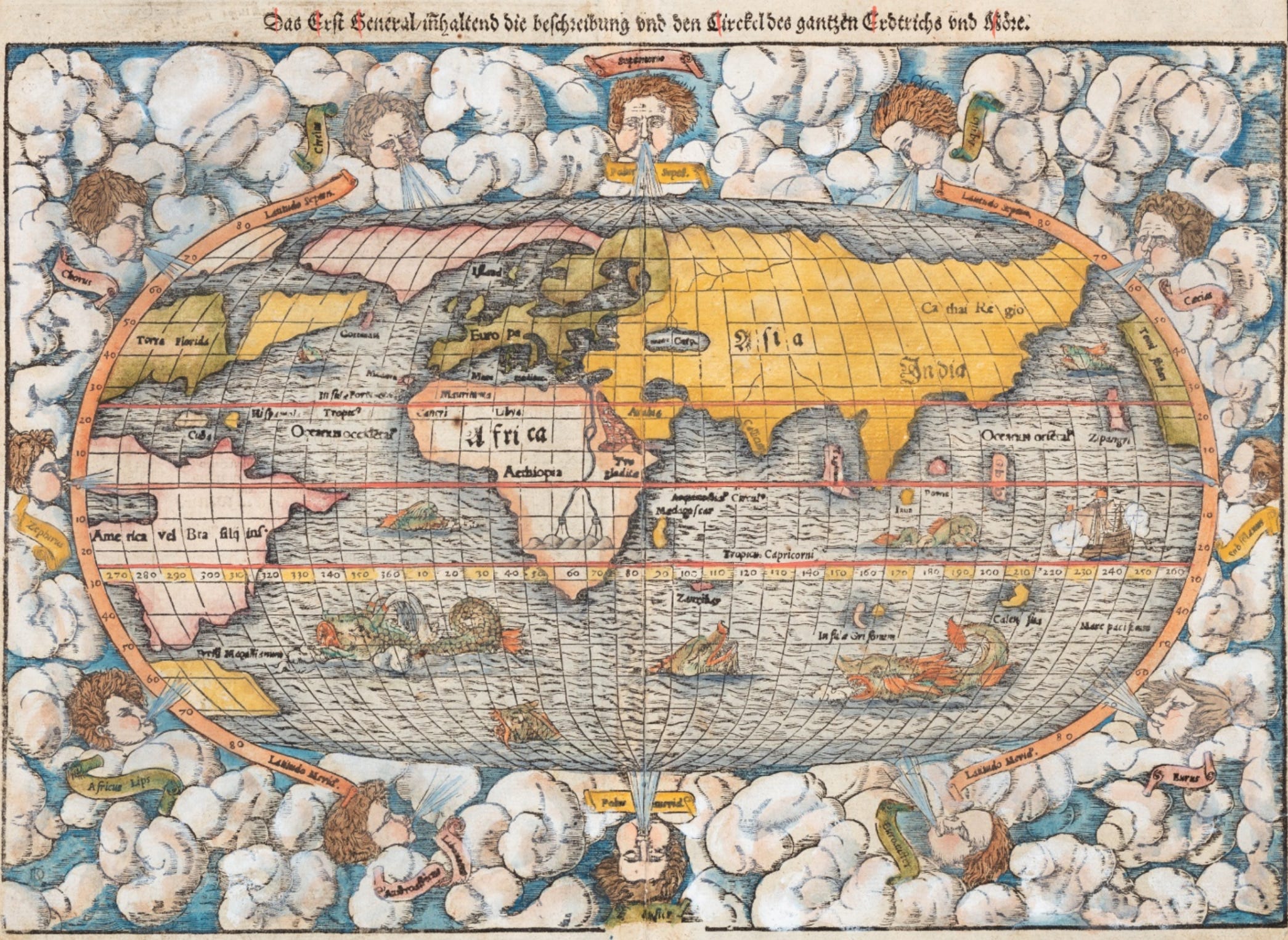
A map can be seen as a virtual projection of ourselves onto a territory. Its imperfect representation of reality used to be evident in its obvious approximation: elements were always left out and what was included was subject to distortions like the Mercator projection. But the reflection seen in today’s maps and models has an unnerving shimmer. They are impossibly complex, radiometrically precise, and vastly improving every day. What began as a tool for navigation has evolved into something verging on an instrument of control, a digital twin of the Earth to virtually prod and study.
There is a limit to what we can know about the world. For some that limit is a taunting challenge, an invitation to explore and push the edges of the unknown. For others it is a sacred boundary, a recognition that some places on the map are best left uncharted. The places across the Earth that defy our attempts to map them are the last holdouts of a mysterious planet, one that we’re making less wondrous and more threatening each day.
In 1961, MIT meteorology professor Edward Lorenz was running a simulated weather program when he rounded 0.506127 to 0.506 thinking it wouldn’t change the results to any significance. He was wrong. So he published a paper with the findings and titled it “Deterministic Nonperiodic Flow” and if you fell asleep reading that you’re not alone. It sat in relative obscurity until he was invited a decade later to give a talk about the study and he chose a different title, one you surely recognize: “Does the flap of a butterfly’s wings in Brazil set off a tornado in Texas?”
There’s a lesson about effective communications in that anecdote, but the more important point is that Lorenz was onto an idea simultaneously revolutionary and one that any farmer could already tell you: the weather is a chaotic system. The natural world is vast, complex, and asymmetrically organized. In a word, unpredictable. And yet that fact does little to prevent our species from trying to predict the future.
By now our atlas of the world is both encyclopedic and somehow entirely inadequate. The NASA-CNES SWOT satellite just mapped the seafloor, but the best climate models were unable to anticipate significant changes to the natural carbon cycle. Scientists can analyze gases from air bubbles trapped from ice cores and reconstruct what past climates generally looked like nearly a million years ago, and yet tomorrow’s weather is forecasted with margins of uncertainty.
The headlines say our climate models are breaking. Others think they were incorrect all along. All models are approximations of the world, but maybe the gist is all we really need.
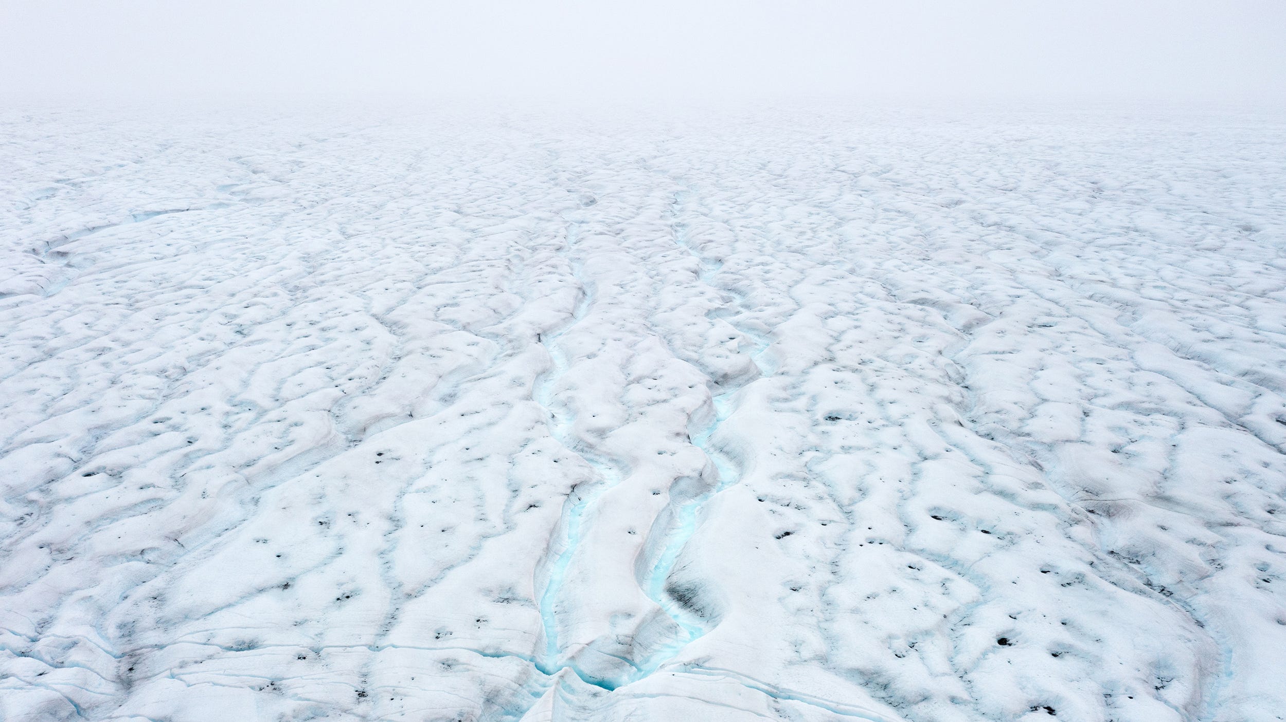
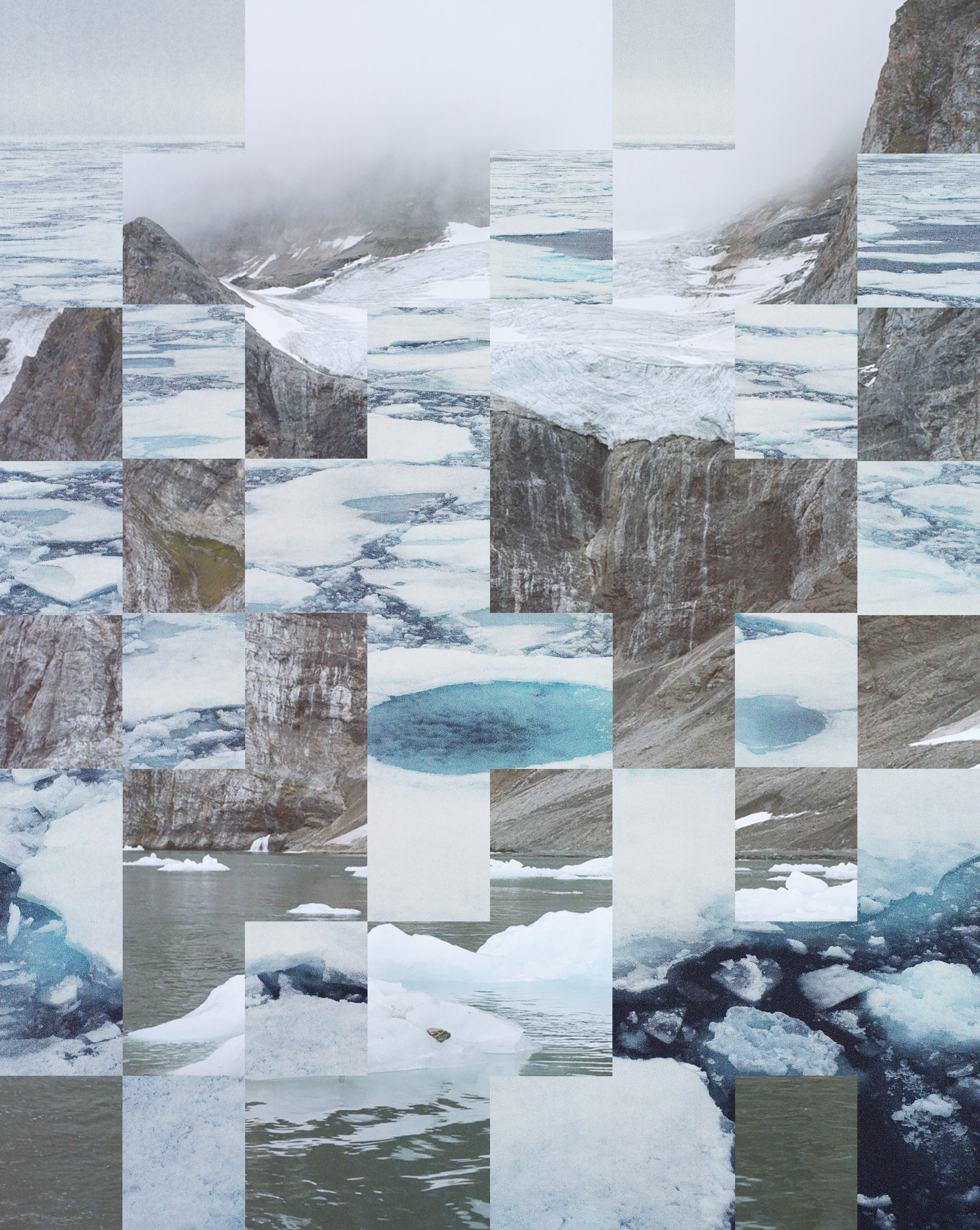
Zoom far enough into any photo and you’ll see squares, the building blocks of an image, the almighty pixel. Put enough together in an organized sequence and you get everything from Earthrise to the latest meme. Seen up close like this and you may even recognize a map—one whose contours are defined by shadow, its landmarks a gradient of color.
An image like this is actually how sea ice area is calculated. Satellites use passive microwave sensors to distinguish between sea ice (which is light) and open water (which is dark). The scan creates a grid where each pixel, or cell, covers tens of kilometers and contains a number based on its water-ice ratio (0 means entirely water and 100 means entirely ice). If it crosses the 15 value threshold, then behold, sea ice!
Unfortunately, each year less of these cells are able to celebrate their quinceañara. Sea ice area and extent are rapidly declining, and researchers at NASA and the National Snow and Ice Data Center just announced a record low for March 22nd, the part of the year it should be reaching its peak. One could pore over the data, but the gist is enough: record ice loss with catastrophic implications.
One of these consequences, however, is particularly concerning, a potentially civilization-ending one at that: the collapse of Greenland’s ice sheet. It’s one of the planet’s tipping points, thresholds where a single small change could lead to massive and irreversible impacts, the last pebble that triggers an avalanche.
For Greenland it’s not a pebble but many molecules of frozen H2O, and not an avalanche but an icy collapse so grand it would raise global sea level by 7 meters (23 feet). It is such a colossal amount of water that it would slow Earth’s rotation and increase the length of the day by about 2 milliseconds—an amount of time far too little to help billions of people relocate from global coastlines.
What has kept that ice locked away is stability. And each day that stability teeters closer to chaos as we chip away at it like Jenga tower. Every block of ice removed pushes this 12,000-ish-year Eden just a bit closer to the edge.
The Goldilocks Earth that allowed civilization to flourish exists in large part because of ice’s sunlight-reflecting properties. Places with lower albedo—meaning “whiteness” in Latin—warm the Earth by absorbing more sunlight, while brighter places have a higher albedo and cool them (think of wearing a white shirt on a sunny day). Sea ice is particularly effective, reflecting about 80% of sunlight that reaches it back into space.
Its loss is momentous. Unlike our calculations for its extent, there’s never been a clear threshold for declaring the emergency we’re in. But if there was one, we'd have passed it long ago.
The etymology of the word “apocalypse” means to ‘uncover, reveal’, and “emergency” means to ‘arise, bring to light.’ Our language holds the memory that a disaster can expose who we really are.
The hemorrhaging of polar ice is, among associated but far more catastrophic consequences, categorically dimming the planet. The Earth now absorbs more, its colors shine less. A sphere not quite as radiant, a world more exposed. It is losing its reflectivity, and with it its ability to resist documentation.
We are obsessed with finding the edge of what we know. But rarely do we reach that yawning abyss, gaze upon it for a few moments, and turn around. Instead we plunge headfirst, often heedlessly, into the gaping maw, barely taking a moment to drop down a few glow sticks before the descent.
I don’t want to live on a planet easily understood. The aspects of life that are difficult to measure are precisely the parts most enjoyable: love, faith, community, a beer with friends by a fire. I’m sure someone, undoubtedly fun at parties, will explain that any emotion like love is a chemical byproduct of neurotransmitters to promote genetic continuation. I recognize the technical truth in that answer but I still believe some forces are more than the sum of their parts. An image is not just a collection of colored squares.


The destruction of the world and our quest to nail down every molecule to a map is a desecration of the sacred. I’m not talking about spirituality specifically, but phenomena that we know to be true but can’t exactly explain within scientific parameters: respecting your elders or honoring the dead. These lack evolutionary or utilitarian advantages, but they compose the bedrock of decency. They are boundaries we, for the most part, do not cross, but their value is not always explicit in measurable terms.
I often think about this when I come across reports on “ecosystem services,” or studies that tabulate the value of nature. They represent an attempt to compress the incalculable utility of, say a mangrove forest, into a measurable framework, like how much money it will save local communities from storm surges. I understand that these figures do matter in the practical world of climate summits and environmental policy, and yet what they actually provide cannot ever be numerically summarized. Using economics to explain why clean drinking water is beneficial feels, well, ridiculous.
What matters for the purpose of this essay is the interface between climate science and public persuasion. Climate models are undoubtedly important—determining the underlying causes of ice loss and methods to slow it should be pursued at all costs. But if the value of healthy polar ice caps is not effectively translated in such a way as to support that science, then the data is meaningless. What good is the ability to calculate the trajectory of a rancid tomato with geophysical precision if it's just to smack us in the face and cut our computation off at the fourth decimal?
A new illusion has emerged: the extent at which we believe this data is going to change us. The variable least understood in the climate models is not the flap of a butterfly’s wings, but the human response to this polycrisis. We communicators point to the numbers and tell people to feel scared like Innies in Severance, but statistics only underscores the spiritual deficiency of the modern world. It is impossible to grasp the importance of nature with numbers alone. We need something else to pick up the mantle when models run into their limit.
Cartographers used to illustrate the uncharted swaths of maps with mythical monsters and dragons. Our innate terror of the unknown likely explains some of our unease around those ship-sinking icebergs. The metaphor they’ve become synonymous with is that there’s always more below the surface than visible on top. But what if we viewed that hidden 90% not as a challenge to uncover but an invitation to let be. To model the world in its entirety is to annihilate the few enchanting remnants that still remain and leave its last dragons slain.
I hope our models improve so that we can better forecast damaging storms, but I hope we have the wisdom to turn around at some thresholds too. Not everything needs to be uncovered, not everything explained numerically. For those of us looking to make sense of the chaotic systems around us, sometimes an approximation and a bit of mystery will do.
While writing this last week, The New York Times published an article with a mythical title: “In Japan, an Iceless Lake and an Absent God Sound an Ancient Warning.” It is the story of a town that has recorded a mysterious phenomenon since 1443. At some point in the depths of winter, a ridge of jagged ice would emerge from the frozen and rumbling Lake Suwa, “meandering like the spiked back of a twisting dragon.” Locals originally believed it was the sacred wake left by a passing Shinto god, and the rare winters it didn’t appear was seen as a bad omen.
It has been 7 years since that sacred ridge formed, and Lake Suwa has been iceless for 18 of the past 25. The scientific research on this planetary heating is robust, readily available, and the reason why so many of us are working on this problem. But as the article’s authors later write: “science has also robbed the ice ridges of their mystery by explaining how they arise.” They then articulate the process, which involves contraction and expansion of the ice. There are no wandering gods as far as the studies are concerned. What a shame.
Written and photographed (unless otherwise indicated) by Ryder Kimball
Some say the world will end by fire, and some by ice.